Eurocode 1 - Wind Action: France Zoning 🗺️
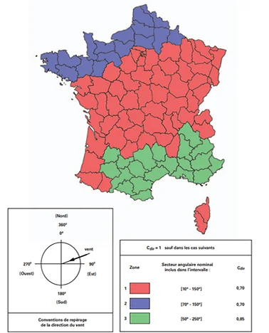
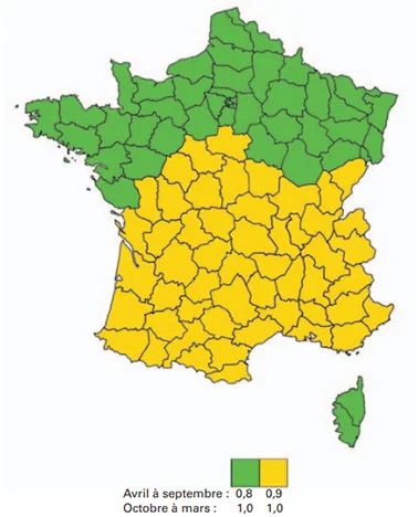
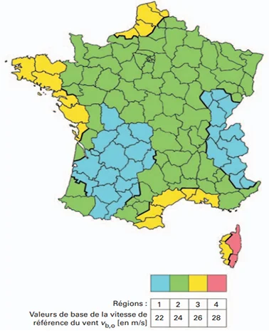
If you are performing wind load calculations according to the Eurocodes1, you need to be familiar with the three maps below!
Mapping of metropolitan France 2:


These three maps are used to determine the reference wind speeds for design purposes by means of three parameters:
- \(v_{b,0}\): basic reference wind speed,
- \(c_{dir}\): direction-based reduction coefficient,
- \(c_{saison}\): season-based reduction coefficient.
To simplify the search for these parameters, we created a geojson map representing
their union, with all parameters included in the metadata.
Within each zone, you will find:
ID:int, a generic id,V_B0:int, in [m/s], basic reference wind speed,C_DIR_ANGL:str, in the formvalue;[minAngle, maxAngle], direction-based reduction coefficient,C_SEASON1:float, applicable from October to March, season-based reduction coefficient,C_SEASON2:float, applicable from April to September, season-based reduction coefficient.
This file is available for direct download via this link .
How to Access the Map Data
- Download the File: You can download the
geojsonfile here . - Open with GIS Software: This file is compatible with GIS applications such as QGIS for direct visualization.
- Read with Python: For data analysis and integration into workflows, use Python with GeoPandas .
Interactive Map Application
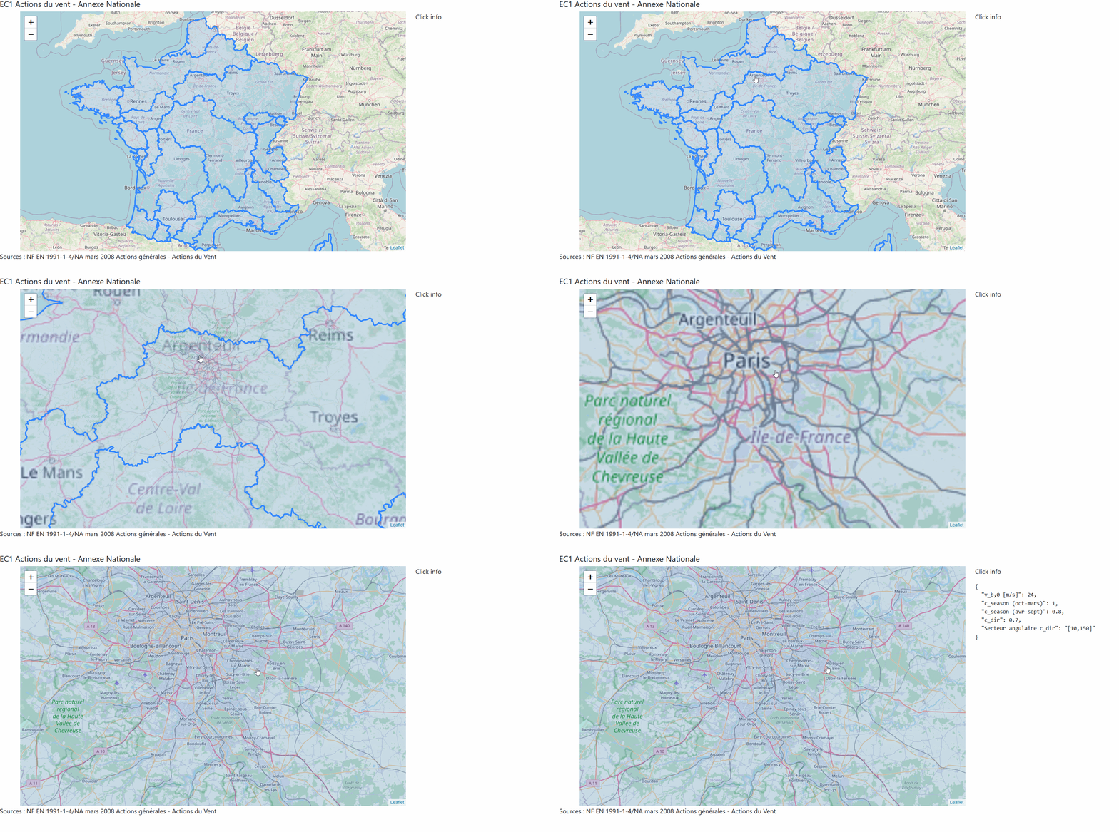
For a more dynamic experience, try our interactive map built with Dash and Dash-Leaflet . This tool allows you to click on different zones in France and instantly view the relevant wind parameters.
Check out the demo here .

This interactive solution is ideal for those needing quick insights into wind parameters for any specific region in France.
Data Source
This project is freely inspired by the work of Grégoire David: France Geojson .
The geographical boundaries used are canton boundaries, following the administrative map of France, published by IGN - Paris 1997 (Edition 2) - as prescribed in the Eurocode. The base file is from the IGN archives GEOFLA
These highly detailed data were simplified via Mapshaper using the VisValingam Weighted method at 25% to optimize file size.